Weather: Soggy week ahead here in Coweta County

From Staff Reports
A wet and mild weather pattern has moved into Coweta County and will stick around through Friday, says the National Weather Service in Peachtree City.
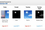
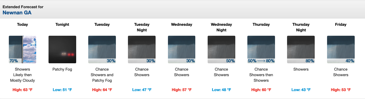
This morning, a 70 percent rain chance remains in play until about 9 a.m. Then mostly cloudy conditions will prevail as part of the afternoon forecast with a high near 63 degrees.
Rain probabilities of 30 percent are listed in Tuesday’s and Wednesday’s forecasts before increasing to 50 percent overnight Wednesday and up to 80 percent both day and night Thursday. The rain begins moving out of the area on Friday as only a 40 percent chance is forecast.
Temperatures will be mild with a high of 64 on Tuesday, 67 on Wednesday, 60 on Thursday and 53 on Friday. Overnight lows will be in the upper 40s.
The next round of cold weather could likely come this weekend as a strong Arctic system tries to plunge into the Deep South. It’ll move off to the Northeast but not before dropping overnight lows on Friday and Saturday down to 33. Saturday’s high will be 50.
For updated weather information, click the following National Weather Service Newnan LINK.
Below is the extended weather forecast for Coweta County.
TODAY – Showers likely, mainly before 9am. Mostly cloudy, with a high near 63. North wind 5 to 10 mph. Chance of precipitation is 70%.
TONIGHT – Patchy fog after 10pm. Otherwise, mostly cloudy, with a low around 51. Calm wind becoming east around 5 mph.
TUESDAY – A 30 percent chance of showers, mainly between 9am and 11am. Patchy fog before 11am. Otherwise, cloudy, with a high near 64. East wind around 5 mph becoming west in the afternoon.
WEDNESDAY – A 30 percent chance of showers. Cloudy, with a high near 57. North wind around 5 mph.
THURSDAY – A chance of showers and thunderstorms, then showers and possibly a thunderstorm after 1pm. High near 60. Chance of precipitation is 80%.
FRIDAY – A 40 percent chance of showers. Mostly cloudy, with a high near 53.
SATURDAY – Sunny, with a high near 50.
The National Weather Service Extended Forecast for Coweta County.